


ANTON SEIMON: CHASING NEW TORNADO SCIENCE
/An iconic elephant trunk-shaped tornado touches down on the open landscape near Campo in southeast Colorado in May 2011. Photo: Tracie Seimon
Interview by David Braun
Photographs by Tracie and Anton Seimon
and Jennifer Brindley Ubl
Anton Seimon has chased storms across America’s deadly Tornado Alley for 25 years. The atmospheric and environmental scientist leads or co-leads five research projects in climatology and meteorology, but for this interview with Exploration Connections, he says, “I’ll put on my tornado hat and talk about the tornado side of things.”
—David Braun
Its roaring circulation clearly audible, an anticyclonic tornado tracks directly toward Anton’s tornado team in Simla, Colorado/June 2015. Video: Anton Seimon
David Braun: With major weather events intensifying the way they are across the world, has your work ever been more critical? Do tornado studies fit into that?
Anton Seimon: Much of my research informs on changes in climate. We look at high-mountain environments, for example. But we don’t have compelling evidence that tornadoes are more frequent or more intense because of climate-change factors.
We certainly see evidence for changes in phenomena like hurricanes and other tropical cyclones, and they do now intensify more rapidly. When we look at the tornado database and try to make similar assessments, there are no conclusive results.

Anton Seimon enjoys a moment of marvel over a severe thunderstorm on the high plains at Killdeer, North Dakota in June. Photo: Jennifer Brindley Ubl.
One of the reasons is that the tornado database is rather poorly developed. To verify tornadoes actually happened, you need either visual confirmation, or a damage track. When a tornado tracks through open grassland it doesn’t leave many visible marks. If it occurs after dark, you may not know that a tornado happened. But that same tornado could have caused immense destruction.
As we improve tornado science, hopefully we can be better at predicting tornadoes and warning people in their path. That’s our major motivating force.
DB: Amateur storm chasers often help in your research. How does that work?
AS: In my very early days on the plains, most storm chasers were scientists, so it was easy as an academic myself to make linkages to them. Nowadays, there are more than a hundred times as many storm chasers out there. We don't know them individually and hardly any of them are researchers, and they come from all over the world. But by using social media that most storm chasers look at, we are able to reach out very quickly after an event, and find people interested in sharing their data with us.
Storm chasers see things and report things potentially very useful to science, but it is all being done in a totally uncoordinated fashion. But if we can contact, say, 30 people who filmed a storm, we may be able turn their information into scientific data.
Time and location are the two major elements we need to control for.
That’s a big task, because most people do not record the exact positions where they were, and what time they were there. They’re not recording what time their camera was turned on and off.
Time and location are the two major elements we need to control for, so we must reconstruct them if the data is to be of any use. If we get this data, we can figure out exactly where and when people film a storm.
Counter-rotating landspout tornadoes track southward in tandem near Cope, Colorado/May 2018. Video: Anton Seimon
Doing this with multiple observers, from different perspectives, we can put together a 3-D visual representation of a storm. We first did this in a comprehensive way for the world’s largest documented tornado, El Reno, near Oklahoma City in 2013.
DB: So the objective is to continue to build and liaise with that community, while getting the standards up to where you need them to be?
AS: Yes. There were key lessons learned from reviewing the materials that 93 individuals or groups sent to us from that El Reno case. We studied what very good data practices looked like, then published optimal guidelines on the web for how to become a more scientific storm chaser.
What’s considered good chasing practices is generally well known, and there are authoritative sites out there, and YouTube videos put together by people like Skip Talbot, that outline these things.
Phones can also be problematic: Suddenly, you may lose your signal… you are lost and no longer have information needed to navigate the storm.
DB: I presume many lay people use their phones to film storms, like we all do to document so much of our daily lives?
AS: Absolutely. Once a storm has developed, the phone is an extraordinary resource. You can bring almost-live radar into your phone. You’ve got great road-navigation tools, you can open a map, you don’t have to have a paper atlas.
A supercell spawns a sunlit tornado near the Black Hills of South Dakota/June 2012. Photo: Anton Seimon
But phones can also be problematic: Suddenly, you may lose your signal. You’ve been dependent on that, but then you are lost and no longer have information needed to navigate the storm.
Now, old-school chasers like myself learned the practice of storm observation before we had these incredible mobile resources. We learned a great deal just by looking at the sky to make sense of things, and navigate around the storm based on those visual cues.
A great worry now is that a younger generation of storm chasers has come up reliant on the digital tools, and that’s all they have.
When you get very close to a major storm with 500 other storm chasers, they are all gobbling up the available bandwidth from the cell towers.
One of the things that happens when you get very close to a major storm with 500 other storm chasers: they are all gobbling up the available bandwidth from the cell towers. Suddenly you start getting data dropouts. Even though there is a cell signal and you may be able to send a text message, you can’t view the latest radar images.

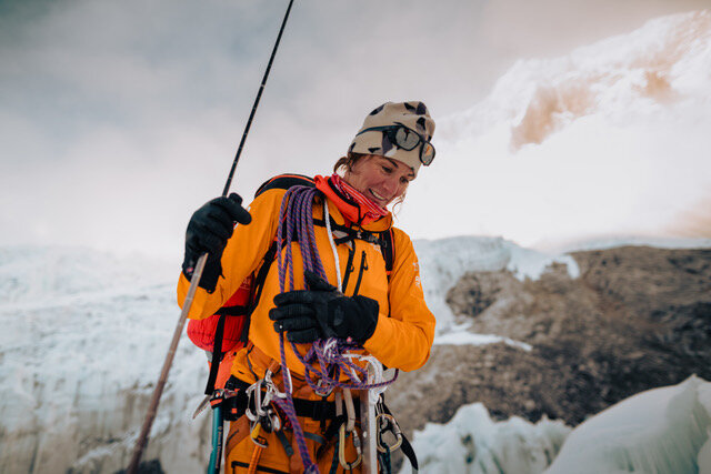
Taking a break from the chase, Anton with his tornado research team in 2019. From left: Hank Schyma, Jennifer Brindley Ubl, Skip Talbot, and his wife—Dr. Tracie Seimon. Photo: Anton Seimon
We learned from that El Reno case in 2013 that many chasers didn't realize that their cell phones were no longer updating radar images, so they had information that was perhaps 10-15 minutes old. They were navigating using their phones based on old information before they realized the predicament they were in. In this way, many people got caught.
We advocate for situational awareness. It’s so easy to get wrapped up: to behold a tornado, to actually see a storm evolve to a point where it produces a tornado. It’s an extraordinary experience. It occupies your every sense. But you need to snap out of that; you need to ask what’s going on around yourself, what else do you need to be aware of?
The greatest hazard by far that storm chasers face isn’t the tornado. It’s other drivers. And one’s own driving.
You may want to get out of your vehicle and go and stand by that barbed-wire fence, stare out across the prairie at this amazing sight. Well, if lightning strikes down the line, that fence is going to electrocute you. So it’s about maintaining proper situational awareness when your instinct and emotion just want to focus on what’s in front of you.
DB: Using the wider community to provide different perspectives of a storm reminds me of “The Whale Detective,” a documentary that investigates a 30-ton humpback whale that breached and just missed landing on a researcher in a kayak. The film was about trying to identify the individual whale based on its unique physical attributes, as recorded by a number of people who recorded the entire incident from multiple angles, including from the shore.
AS: I’m really interested in the whale as metaphor. I’ve likened what happened at the El Reno storm to Moby Dick, in a particular context.
For the storm-chaser community, the 2013 tornado was the whale that came down on the boat. This tornado came down on hundreds of storm-chasers. It was a tornado with dimensions we’d never seen before, that acted in very unusual ways. Suddenly speeding up and suddenly changing direction as it expanded. We were overwhelmed by this enormous circulation. It was so large that most people could not recognize that this was a tornado; it was as wide as Central Park is long.
Then one time, suddenly it’s different: the whale comes down on the boat.
What happened is quite analogous to the breaching whale, where every day a whole flotilla of vessels can go out to observe a phenomenon they know will occur at a certain place. But then one time, suddenly it’s different: the whale comes down on the boat.
That’s what happened in El Reno in 2013, and unfortunately my former teammates—Tim Samaras, his son Paul, and Carl Young—were killed in the unprecedented storm. Eight people died in vehicles from this tornado, three of whom were very dear to me. There is a very emotional component in trying to understand what really happened with this particular storm
From that tragedy, we’ve leveraged a whole research program, using novel techniques and generating novel findings, and really substantial progress has been registered.
I’d do anything to get my friends back, but in a sense, at least their deaths were not in vain from a scientific perspective. They were out there trying to get scientific data. They were a science team funded by National Geographic, and, according to Rebecca Martin, longtime director of the Expeditions Council there, that was the first time that National Geographic lost an entire research team.
DB: Your current research, you say, is an outcome of what happened in 2013. Unpack that a little more.
AS: If you can fix video location and time from multiple perspectives you can start putting things together in really interesting ways.
What is the biggest question about a tornado from human-hazard perspective? It relates to how strong the wind is at the surface.
One would think in the year 2020 that surely this has been known for many years. The truth is we don’t know how strong tornadoes are at the surface. That lowest ten meters is where almost all the damage is inflicted, where all the human structures are, where we dwell.

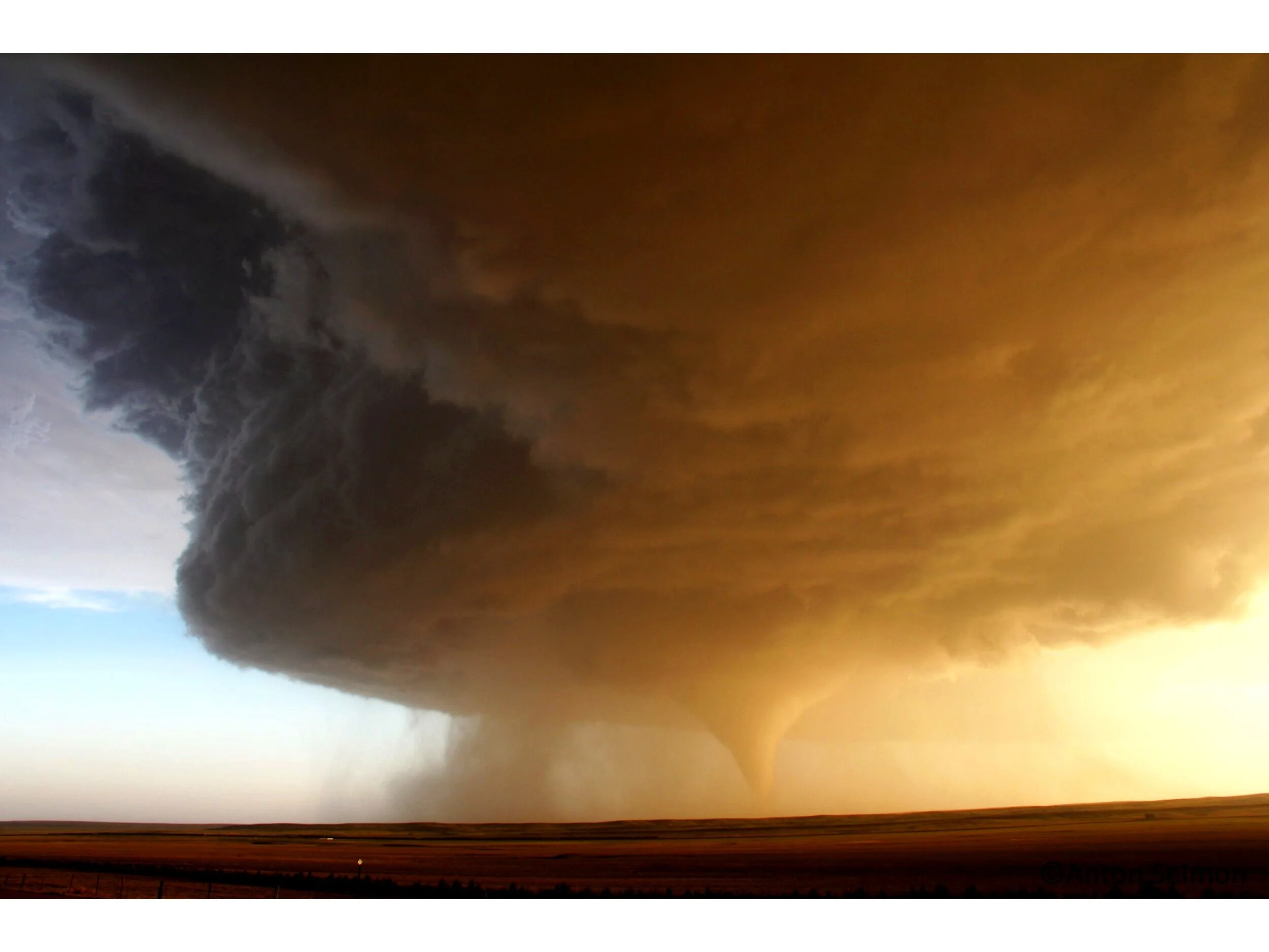
A rare, anticyclonic (clockwise-rotating) tornado tore through the open prairie near Simla, Colorado in 2015, lofting enormous amounts of soil around its funnel cloud. Fortunately, the twister passed by several farmsteads without causing damage or injury. The price of this view by Seimon’s team: A cracked windshield from baseball-sized hail. Photo: Tracie Seimon
Tornadoes have a very unusual characteristic, from a physical standpoint. It appears that the winds are maximized right down near the surface. Now that goes against physical logic, because friction is maximized at the surface, versus the free atmosphere above.
But from all the evidence that we have, the extraordinary phenomena that are registered by strong tornadoes, what they can do, from a damage perspective—taking large vehicles and tossing them great distances, lofting them in the air, and that kind of stuff—is amazing.
Well, what type of wind does it take to do that? We’ve gotten an approximation through use of tools like mobile Doppler radar. A radar beam provides a near-horizontal slice through the storm that lets us measure the relevant motion towards the radar or away from the radar. Those motions let us take the difference and calculate the rotational wind speed; therefore we can come up with an estimated maximum.
But the problem with a radar beam is that we have to scan above the surface. If we come down right to the surface, the beam gets broken up by terrain, by objects on the ground. It’s called beam blockage or ground clutter.
Radar is very effective from around 100 meters or more above the ground. But what’s actually happening where it counts for humans is largely unknown.
So, radar is very effective from around 100 meters or more above the ground. But what’s actually happening where it counts for humans is largely unknown.
There’s another thing going on. Radar is basically telling you what’s going on within the [tornadic] component going towards the radar and away from the radar. But what’s obvious when you watch videos of tornadoes, you will see that near the surface what starts off as horizontal motions spiraling in, as air enters the tornado funnel, abruptly yanks upwards in a very steep spiral, so it now has a vertical component, the lifting upward.

Anton and Tracie Seimon with the tornado research team this spring in the Black Hills of eastern Wyoming. Devil’s Tower looms in the background. Photo: Jennifer Brindley Ubl
It’s not just the horizontal wind speeds that counts, which of course are incredibly strong, it’s that vertical force which can actually loft objects as well. You’ll see roofs being peeled off houses.
The Doppler radar is not the best tool for observing something like that. Videography, assuming you have a pretty unobstructed view, is potentially more informative in that regard, to really understand the trajectory that wind motions will follow.
Video doesn’t see winds; it sees particles that are moved by the wind.
Now of course, video doesn’t see winds; it sees particles that are moved by the wind. If they are very large particles—rooftops, vehicles, whatever—friction and centrifuge and other factors really distort the motion relative to the wind field. A car is not going to be moving at the speed or along the path of the wind. However, very fine particles, like leaves, dust or even water vapor itself, in the funnel cloud, those really do approximate the airflow.
Many chasers are now toting 4K video cameras, and even higher-resolution is becoming available. What we’re doing in our current project is to strategically deploy multiple cameras close to a tornado, but in different positions, all shooting 4K video simultaneously. And from that, deriving those particle motions in three dimensions. You put it all into computer software for tracking particles and proceed frame by frame, 30 times per second, which is really a lot of information.
Just one second of common video footage from multiple perspectives gives us 30 individual snapshots.
Given the strength of the wind fields we’re looking at, just one second of common video footage from multiple perspectives gives us 30 individual snapshots. And 30 chances to map out how each of those little clusters of particles are moving. Then if you’ve got those measurements, and you see them in two dimensions from this side and two dimensions from that side, put that all together if you can control for time and location—then we are starting to derive 3-D motions right down to the surface.

A luminescent supercell thunderstorm dissipates above a Nebraska sunset/spring 2012. Photo: Tracie Seimon
DB: Is there a practical outcome for all this research, apart from understanding the phenomena of tornadoes?
AS: If we derive actual measurements—inferred measurements we can call them—it’s not like putting a wind sensor in the tornado, rather we’re tracking the particle motions to determine what those air flows look like. If we really can generate such results from a series of tornadoes of different intensities and different morphologies, and compare that to the resulting damage experienced at the surface—be it damage to vegetation or damage to structures—then we can start developing a more robust understanding of how one might engineer structures to survive tornadoes.
Right now, building codes in the middle of the United States work on relatively coarse assumptions about how strong the average tornado is. But is it possible to engineer structures to be somewhat more aerodynamic to those uplifting forces?
Anything we can do to reduce the exposure that humans and their products have to experience should a tornado strike, that’s something that’s desirable and attainable.
DB: On a personal note, tornado research is an experience you share with your family. How does that work?
AS: When things are intense out there, Tracie is the driver and I’m doing the navigation and meteorological interpretation. She takes still images, I do the videography. And our support team in the back are two hounds. It’s a family vacation we take every year. The hounds are frequently seen in our storm footage; they are the stars of the show. And they also keep us safe; we never forget that we have them with us; their wellbeing is our wellbeing as well, which is a terrific part of sharing the experience.

Storm hounds Squire and Jody (right) keep an eye on a severe storm as Anton and Tracie Seimon communicate with their research team on a chase in 2017. Photo: Anton Seimon
The truth is that storms are present for just a tiny part of the time we spend out there in the great expanse of the United States looking for storms. There’s all this other stuff going on. There’s the vast agricultural lands, all the open grasslands, maybe the distant mountains when you are closer to the Rockies. Our time out there has greatly increased our consciousness of the splendor of these landscapes, vast skies, and the pure air. We’re just mesmerized. We love, love being out there.
Tracie and I are both mountaineers. We go about the world hiking and climbing great mountains, but from storm chasing we’ve learned to love the flat places, the expansive grasslands, and especially native prairie wherever we can find it.
And we camp there. At night the skies are ablaze with distant lightning and the stars, and there’s the smell of the prairie on the wind, and sagebrush. It’s incredible. We camp in our vehicle, on the prairie, and wake up to the sounds of birds. Then we go running in the mornings with our dogs on trails and dirt roads. We love viewing wildlife and birdlife, another great passion of ours, as we work in wildlife conservation as well.
We’re very unusual in the storm-chasing community for experiencing nature in this way by camping out on the Great Plains. It’s our pilgrimage, every year for at least three weeks, and it is an absolutely extraordinary experience that we love and that is part of our lives.
INTERESTED IN BOOKING ANTON SEIMON TO PRESENT AT YOUR EVENT? PLEASE CONTACT US.
Related research article:
”Crowdsourcing the El Reno 2013 Tornado: A New Approach for Collation and Display of Storm Chaser Imagery for Scientific Applications,” by Anton Seimon, John T. Allen, Tracie A. Seimon, Skip J. Talbot and David K. Hoadley. Bulletin of the American Meteorological Society, December 2016.
More of Anton Seimons’s academic papers are listed on his Research Gate page.
Retired journalist David Max Braun lectures, writes and mentors on effective digital content strategies. You can connect with David on Linkedin.